Minor Updates Aug 2022

The hike from Big Sur Station to Hot Springs is a 20 mile in and back trip. Sykes Hot Springs is one of my favorite places to take first time backpackers who are reasonably fit. The destination has some nice hot springs and a trout filled stream. The hike is pretty. The trip is long enough that people have a sense they have accomplished something, but short enough that it’s not overwhelming for many. The trail is easy enough to follow that no maps are needed and there is little to no risk of getting lost. There are a number of clear milestones, so people can easily see that they are making progress. The conditions tend to be moderate year round so there is never a bad time to go. Sykes is only a two hour drive from the bay area, so it can easily be done in a 24 hour period, though some people like to take several days by the hot springs and/or the river. For people who are fit, It’s also doable as a day hike. The only down side is that you aren’t going to find solitude, except maybe Tue-Thu in the middle of the winter.
Current Conditions
In Aug 2022 the trail from both Big Sur Station and China Camp were open and easy to navigation with minimal deadfall. Kudos to the the trail workers who repairs the trails which have been closed for several years due to fire and flood damage. As always, check current conditions before planning a trip via Pine Crest Trail Conditions. If you have an a satellite communication device like Garmin’s InReach you can send Sykes coordinates “36.25,-121.69” to 765-553-4737 (aka trailinfo.org) and get status of any fires within 50 miles.
Hike Description
This trip is into the Ventana Wilderness near Big Sur. The hike is ten mile each way. The hike starts at 400 ft elevation and hits a maximum of 1500 ft, but over the course of the hike you will climb approximately 3000 ft and descended 2000 ft. Craig suggested this should be called the elevator trail since it kept going up and down. The destination campsite has hot springs and a stream. There are a number of other campsites along the way. The Pine Ridge Trail mostly weaves through a cover of redwoods, pine and oak. The trail is typically well maintained and extremely easy to follow. In the winter months, especially after a storm, you might find dead fall, or short sections of trail washed out… but these tend to be repaired reasonably quickly. April – October the trail is typically clear.
Someone in decent shape should be able to hike in in around five hours, and come out in around four.. this is an enjoyable pace for me. Even out of shape, middle aged men can do this hike in less than seven hours, unless they have bad blisters, in which case it might take something like eight or nine hours. I am not the fastest hiker, and I have done the hike 4 hour in, 3 hour out. If you want to witness people going quickly, stop by the day before The Big Sur International Marathon and get passed by people “warming up” on their way up and down.
Part 1: Getting past the campsites
The trail head is at the far end of the parking lot of the Big Sur Forest Service Station. There is a small kiosk and a drinking fountain. Today you walk around 1000 ft and then the trail drops to the campground below. You will walk through the camp area until just after spot #31 at which point the Pine Ridge Trail leaves the campground and rejoins the original trail.
Part 2: Up and into the Hills
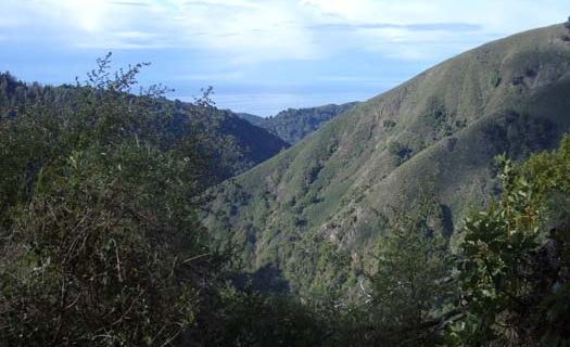
The next 2.5 miles of the trail are up hill, taking you away from the ocean. Around 40% of this section is on exposed hills which can heat up in the spring and summer sun, but you will can get a nice view of the ocean in some of the clearings. You will start up a series of small switch backs as the trails gets increasingly steep. Around 1 miles in, you will break out of the trees and start the uphill in earnest. For the next mile the trail will be ascending almost continuously, with some short sections being quite steep. This is one of the hardest up hill sections of the trail. The sign indicating you have entered Ventana Wilderness is at the 2 mile marker.

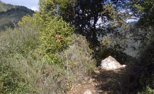
The next mile will trend upward, but there will be sections which are flat or downhill as you cut across the hillside. Around 2.8 miles in you will find yourself on a sort of outcropping with a large rock on your left. It’s time to celebrate because this is the end of the up hill climb you have been doing for the last 1-2 hours. This is a very popular place to stop and enjoy the last view you will have of the coast. Some people like to have a snack or lunch at this spot. I like to take a very short break here to drink a bit of water and then continue on to Terrance Camp.
Part 3: Cruising Down to the Streams
The next four miles are much easier than the first three with only a few hills to climb. The trail is mostly a gentle drop. Most of this section of the trail weaves in and out pretty micro canyons. At the three mile mark is a trail on the left which goes down hill to Ventana camp. [Sometimes the sign is missing.] At the five mile mark you will come to Terrace camp, a lovely place to stop. The area is nicely shaded with a stream for water.
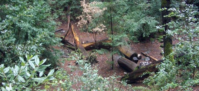
The stream can be easily crossed using stepping stones. Just passed the creek you can go left or right. Left is continuation of the Pine Ridge Trail which will take you to Sykes camp. To the right the trail takes you Outlaw camp. There is a a pit toilet just up the trail toward Outlaw camp. The trail has a slight climb as you exit Terrance camp. Around 6.5 miles in you will start down a series of moderate switch backs which take you to the next creek you need to cross. Much of the year it is possible to cross this creek without getting your feet wet if you are careful. The best place to cross is typically slightly upstream where there is a large fallen log. When the water is really running high you can cross the stream on the large tree that fell over the stream which is maybe 200 yards upstream.
Part 4a: Down to Barlow Up and Back Up to the Trail
Once you have passed the creek creek you are beginning the next up-hill section of this trip. At the seven mile mark you will see a turn-off on the left side of the trail for Barlow Flats campsite. Historically you would continue passed Barlow Flats, but the former trail is washed out. Now The Pine Ridge Trail descends to Barlow, crosses the the river.
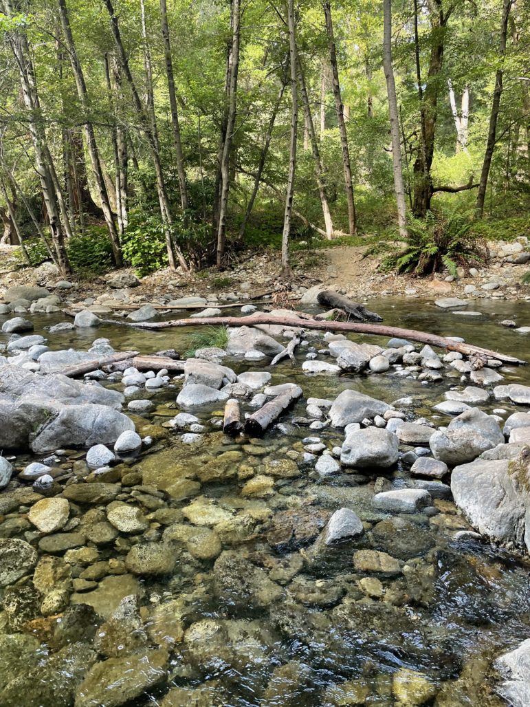
proceeds upstream several hundred feet, and then crosses the river, and climbs up the hill back to the old Pine Crest trail.

Part 4b: Over the Last Hill and Down to the Springs
In the next mile or so the hike will get progressively steeper, but is still very pleasant. You know you are near the end of this section when you reach the tree burnt out trunk. This used to be a nice place to stop and have a brief snack before climbing up the last steep climb on this hike


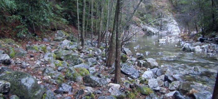
Once you reach the top of the switch back you will have a pleasant mile or two as the trail slowly drifts down toward the river below. Shortly before you get to Sykes the trail will descend a set of steep switchbacks to the river below.
Part 5: Campsites
Now it’s time to decide where to camp. Both sides of the river have a pit toilets. The hot springs are on same side of the river as the trail from Big Sur. If you want a bit of privacy, I would recommend camping on the far side of the river. There are more campsites on the far side, and you don’t have a constraint stream of people walking past your camp on the way to the hot springs.
Part 6: Hot Springs
To get to the hot springs, walk down stream. You will eventually come to a rock face sticking out from the side of the hill. If you are careful, it it possible to climb around the rocks and continue down to the hot springs. Most people, take the safer route, and wade across part of the stream to a jetty (sometimes island when the water is really high).

Continue from the jetty along the left side of the river. You will pass below a pit toilet which is on a step above the river. Follow the river until you see a trail heading up the hill. It will look like you could go a bit further by the river, but I don’t recommend staying by the river unless you want to wade / swim down the river to the hot springs. Follow the trail up the hill. Twice the trail will take you up the hillside and away from the river to get around small cliffs. After the second up-and-over you will be just short of the hot springs. You will know you are close when you smell a slight sulfur odor.
Historically there have been 2-3 soaking pools. One it typically up the hill, while two are down near the river. The pools have been formed using a combination of plastic piping to direct the hot springs output, and sandbags to hold the water in a pool. As of August 2022 the forest service has been actively working to keep this area more natural, having removed the sandbags and piping. The pools are not just rocks. It’s not quite as comfortable as the previous incarnation but still a joy to use.


Keep in mind that some people (maybe 20-30%?) treat the hot springs as clothing optional. A little bit of etiquette can prevent embarrassment and conflicts. Since there are multiple pools it is unlikely that all will be filled with people clothed or unclothed. If naked soakers make you uncomfortable, go to an empty pool or one where people are wearing suits. If you like soaking without clothing and all the pools are filled with people in swim suits, ask if they would mind if you soak without clothing. I am sure that all the people in at least one of the pools would say they don’t care.
Getting There:
Big Sur is a two hour drive from Mountain View if you don’t get hung up in traffic. Take 85 south to 101 south. Take 101 passed Gilroy to the exit for 156 west (Monterey Peninsula). From 156 you will want to take Highway 1 South. Take Route 1 past Monterey and Carmel. Big Sur is 30 minutes beyond Carmel. The entry to Big Sur Forest Service Station will be on the left, is approximately half a mile passed the main entry for Pfeiffer Big Sur State Park. The trail head for the Pine Ridge Trail is at the far end of the parking lot.
Permit Info:
You can pick up a free fire permit at the Big Sur Forest Service Station (8am-4pm) or online after watching a 4 minute video and taking a quiz.
Parking is self serve $10/night… bring exact change and a pen to fill out the form. You have to pay for partial days, not 24 hour periods of time. I got the impress the day “ends” at 3pm. So if you arrive Friday, and come out Saturday in the early evening you might need $30. Read the instruction at the kiosk more carefully than I have.
Wilderness permit is self issued at the trail kiosk.
Weather
You can see current conditions at weather.com – Big Sur. The conditions tend to be pretty mild. Late Spring through Early Fall the days tend to get into the 70s or 80s during the day, and down to the 50-60s at night. Note: It will typically be warmer in the summer at Sykes then by the coast: my last visit it was 68F in Big Sur and 90F at Sykes. The weather in Soledad, CA might be a better indication of the temperatures at the hot spring. It almost never rains with modest bug pressure. It’s possible to ignore the bugs, but I would generally recommend bring some sort of protection. Late Fall through Early Spring I would be prepared for some rain, with days to be in the mid 50s to low 60s, and the nights to get down into the lower 40s.
Personal Supplies
We have a Basic Gear Check List if you aren’t sure what you need to bring as well as a few notes about Getting Starting Backpacking. There are numerous gear lists on the web which might give you other perspectives / ideas. You should bring a towel for the hot springs. I sometime hike in River Shorts which I also use when swimming the river and soaking in the hot springs. In the colder month I save weight by leaving my swim suit behind and soak in a pair of dark colored capiline boxer shorts with the fly sewn shut which provides adequate coverage for modest.
Grouping & Group Gear
N/A – will update next group trip.
Physical Preparation
It is possible to find hikes which are similar in terms of elevation gain and distance. Some examples are: Mount Tamalpais, Fall Creek, Black Mountain, Purisima Creek, El Corte de Madera Creek, and Rancho San Antonio.
Long Ago Group Trips
- April 27-29, 2003 trip with Andrew, Holly, Mark, Craig, Sam, and Cary. Cary has posted Sam’s pictures
- May 24-26, 2003 trip with Cyndy, Erik, Hubert, Katja, Mark, Mike, Nancy, Paul, Taylor. Group
pictures(site gone).
Other Information
- Pfeiffer Big Sur State Park
- Ventana Wild website
- AllTrails Sykes Page
- The bathroom by the trailhead doesn’t have heating or cooling, and only has cold water. The bathroom on the site of the ranger station has hot water and is heated / cooled as is the station.
- On your way out, eat at the Big Sur Bakery. About 1 mile south of the park on the west side of Route 1. Excellent wood fired oven pizza, many other tasty items. Their chocolate pudding is really good. If the Bakery is closed try the Rio Grill in small shopping center on your right just as you get into Carmel.


This looks fantastic, need to visit someday